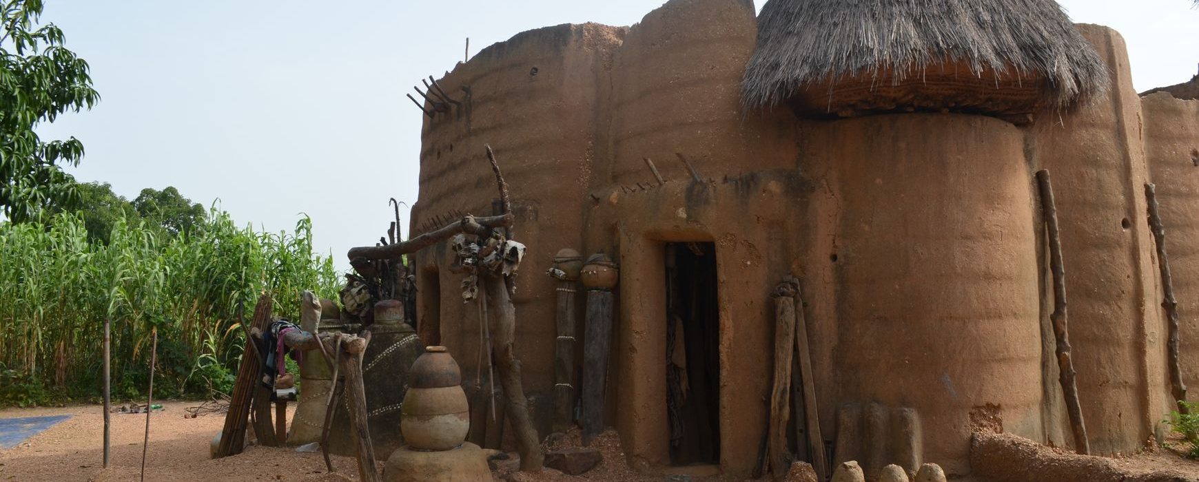
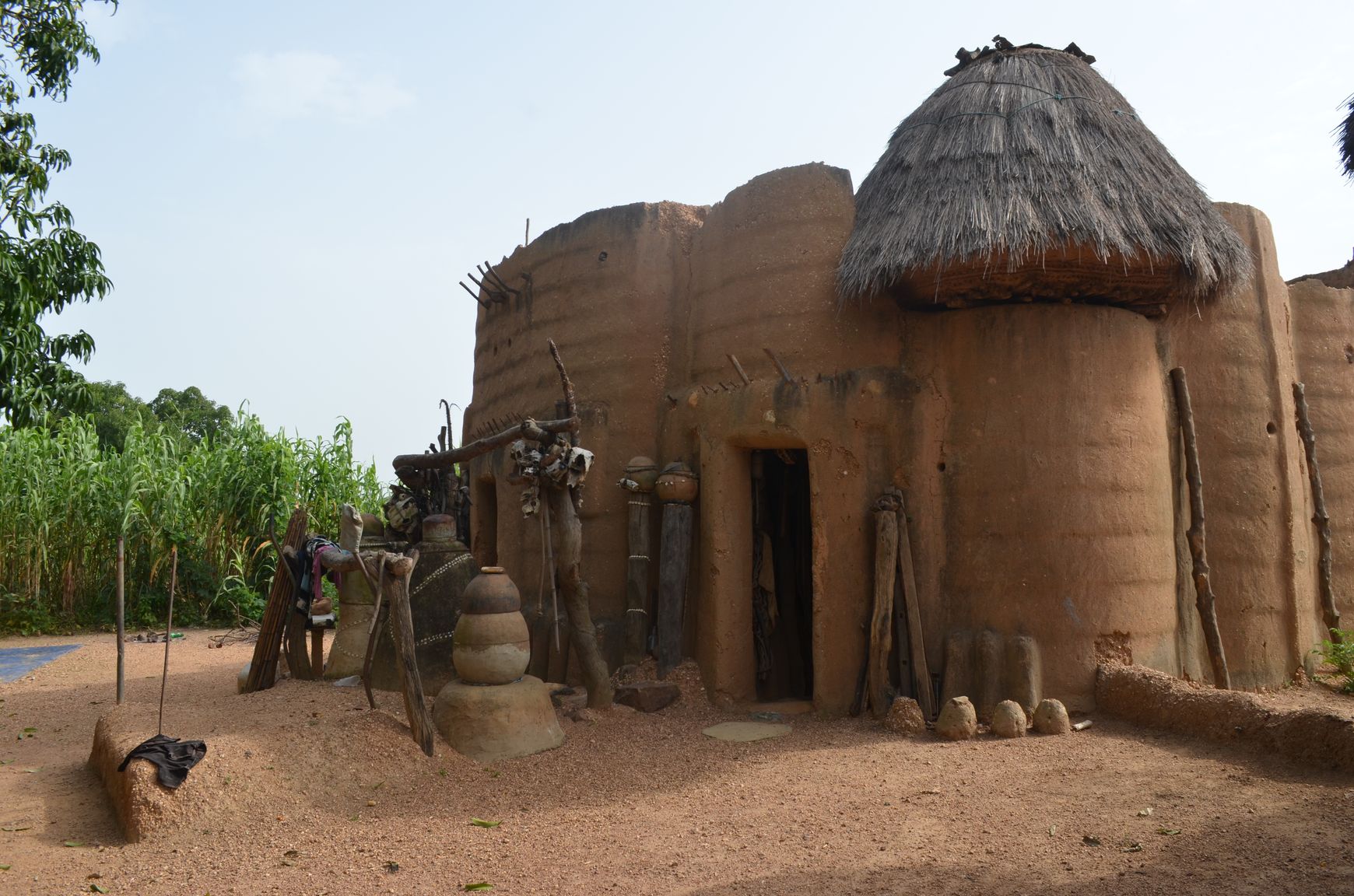
Celebrating the Tata Sombas
The French Institute in Benin is organising an exhibition devoted to the Tatas, the remarkable architectural heritage of North Benin, from April 16th to 30th 2019. This exhibition comprising photographs and mapping of the tourism sites is compiled from data gathered and produced as part of the project to modernize Continue reading


