The IGN FI/ GEOFIT/ LADEC consortium has just completed the land tenure security project in the communes of Buhinyuza, Isale and Matongo in Burundi: an interview with the 2 project leaders.
What did this project consist of?
Burundi, which is part of the “Bonn Challenge” – a challenge to restore 150 million hectares of degraded and deforested land by 2020, and 350 million hectares by 2030 – and the African Resilient Landscapes Initiative, has committed to restoring one million hectares of land by 2030.
The World Bank is supporting the Government of Burundi through the Burundi Landscape Restoration and Resilience Project (PRRPB).
Supported by the Burundian Ministry of Environment, Agriculture and Livestock, land certification is a sub-component of the PRRPB that aims to clarify, formalise and secure land rights, as well as to support the resolution of land conflicts in the project’s communes and hills.
In concrete terms, our activities were carried out in 3 communes in Burundi (Buhinyuza, Isare and Matongo) and focused on 3 main areas
- Strengthening decentralised land management, in particular by supporting the creation or strengthening of the communal land service
- Technical and logistical support for land certification operations on the 26 hills of the 3 communes
- Taking into account cross-cutting issues such as access to land and securing land rights for women and the most vulnerable.
It is important to be aware that in Burundi, more than 70% of the cases brought before the Burundian courts are related to land.
The aim of this component is therefore to establish a clear, systematic and reliable vision of the limits of private property and the national domain, to identify and know the owners, and to identify and attempt to resolve conflicts relating to land.
What are the concrete results?
Aurélia DECHERF – IGN FI Project Manager
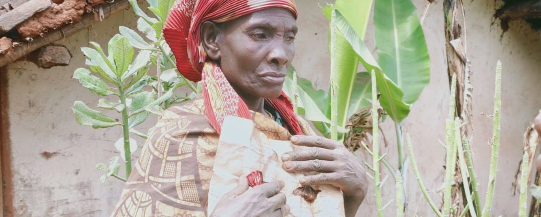
The results of the project are very concrete. The group has proceeded with massive and systematic certification of 26 hills in 75 of the target communes. In the field, this represents the realization of more than 105,000 public and contradictory socio-fonciary surveys (called hill surveys) and the production of more than 100,000 land certificates. In addition, a land information system was set up to produce land documentation for the benefit of the population and the communes.
These good results are the result of a strong acceptance of the project, both by the communal leaders and technical actors who worked in the field in conditions that were not always easy (rain, accessibility problems, etc.) and who had to be trained, and by the populations who understood the social and economic benefits of the project. This is the meaning of the awareness-raising actions that were carried out throughout the project by the group.
GEOFIT has developed the production tools. What constraints? What functionalities?
Development team – GEOFIT
The constraints were multiple. The objective was to obtain a tool that would allow the management of land procedures, forms, bundles of documents, geo-referenced objects, photos and signatures, while operating without any connection. We therefore developed a massive production tool, manageable and customizable, to meet the needs of the project.
Once the users were trained, the tool made it possible to create a link between the field, the local offices and the workshops. It was decisive for the smooth running of the project and proved to be stable, easy to use and efficient.
What made you proud?
Development team – GEOFIT
Once the users were trained, the tool made it possible to create a link between the field, the local offices and the workshops. It was decisive for the smooth running of the project and proved to be stable, easy to use and efficient.
Aurélia DECHERF – IGN FI Project Manager
In addition to the adherence of the populations, which leads to the massive formalisation of rights, which reinforces social peace and contributes to development, the land tenure security component has contributed to significant progress in terms of access to land and the recognition of the rights of women and marginalised populations. Indeed, whereas until then women had great difficulty accessing land rights and registering them, we have been authorised to experiment with the registration of women and both spouses on all official documents. As a result, more than 70% of the plots have women’s names on them, which is remarkable in a context where women do not inherit and have great difficulty in accessing land by other means. I feel that I have, at my very small level, contributed to improving the situation of the project beneficiaries. This is the meaning of this project and of those we are conducting in the land sector in general.
To go further – Listen to the report