Financed by the Green Climate Fund (GCF) with the support of the French Development Agency (AFD), the Integrated Flood Management Project in Senegal (PGIIS) is being carried out in its component 1 by the IGN FI/BRLi consortium. The main activities of this component are the production and dissemination of cartographic data on the entire national territory and on 7 pilot zones considered to be the most vulnerable to flooding.
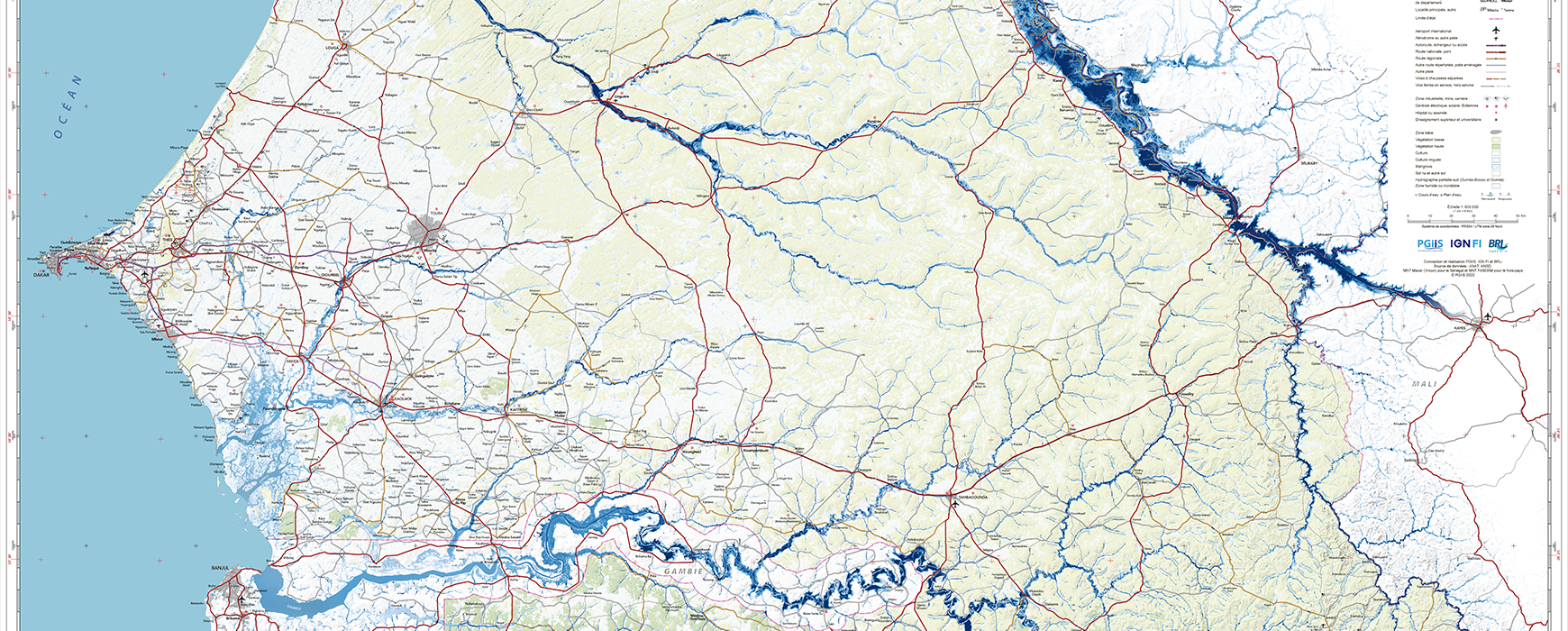
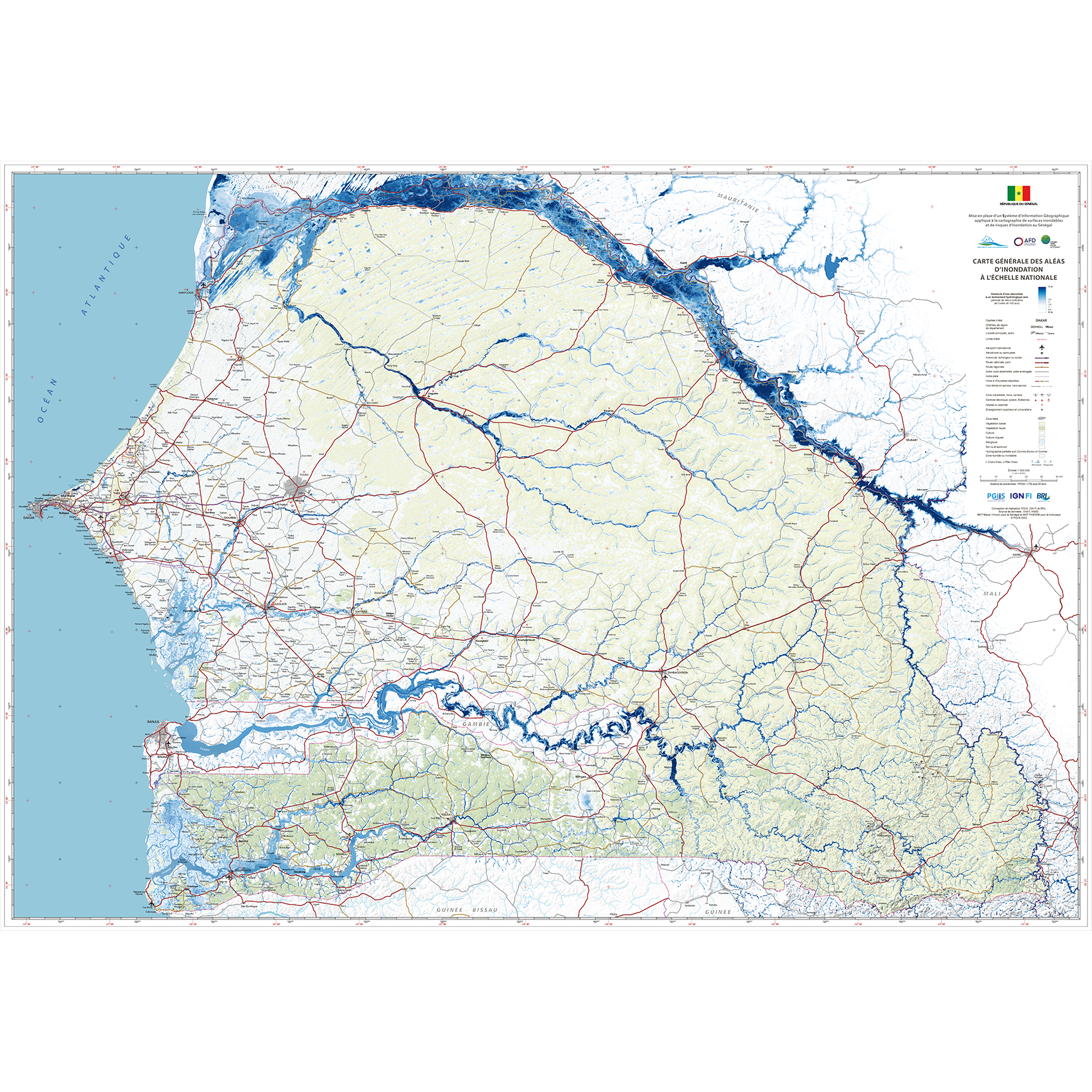
At the national level, the production of national mapping data has been completed. These data will be available through a geoportal and a geocatalogue, a prototype of which is currently being defined.
For the 7 pilot areas, data processing and production activities are underway, including:
- The aerial data acquisition campaign (image and lidar) has been completed
- The field measurement of calibration points (stereopreparation) has been completed
- The creation of digital terrain models, orthoimages and vector databases underway
Hydraulic modelling work has begun, with a first model calculated on the Sine basin between Touba and Diourbel and is continuing on the Dakar-Tivaouane-Joal triangle.
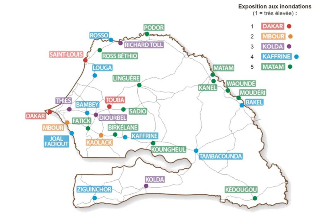 Map of the 29 cities/locations identified as most at risk in Senegal