Crops inventory, agricultural acreage and yield estimations over the Nile valley and delta, EGYPT
After the wheat crisis that took place in Egypt in 2007 and caused by an under-estimation of wheat imports, the Egyptian Ministry for Agriculture decided to implement new means of measuring agricultural acreage and yields in order to verify that the statistics issued to Ministries by the various Egyptian governorates were still reliable and not obsolete. The objective was to check that the expansion factors applied by the statistics departments from one year to the next to measure acreage and yield were not too abstracted from reality and would not bias the end results.
The goal of this project was to provide new and reliable information to the Ministry for Agriculture, help in managing its agricultural policy as well as a better understanding of the Egyptian agricultural production potential. However, the most important aspect of the project was to provide a reliable method that could be implemented rapidly, enabling coherent statistics to be issued for the years 2008 and 2009.
Thanks to the effective transfer of skills and knowledge, IGN FI was able implement an effective way of working with local Egyptian experts. This transfer consisted in creating a protocol for areal statistics-based methodology which enabled acreage to be assessed for the main crops as well as an estimation of yield for wheat and cotton.
The methodology implemented by IGN FI was proposed and validated by an international expert from the French Ministry of Agriculture.
The sampling plan used was modelled on the TERUTI / LUCAS project (Land-use / cover area frame for statistical survey) led by Eurostat in 2001 and implemented in 23 EU member states in 2006. A systematic sampling program used 30,000 points covering the entire Nile Valley and Delta.
Main objectives and deliverables
The CIPA project’s overall objectives were the following:
- Create an inventory of winter and summer crops
- Assess the crop acreage for winter and summer crops
- Assess yields for cotton and wheat
- Assess the influence of small irrigation channels
- Assess the level of contamination caused by water hyacinths in irrigation and drainage channels
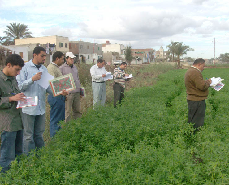
In order to reach these objectives, a systematic sampling plan with over 30,000 points was put in place over the entire area. A field surveyor carried out a field visit at each of the sampling points. This visit enabled precise information to be collected (crop types, tree cover, description of the environment, presence of canals, drains, hedges, etc.) in a relatively short time (2 ½ hrs).
Each field surveyor applied a simple standard survey method, following the instruction guide, and filled out an investigation sheet systematically for each visit. In this way, the information noted on the investigation sheet was based on a standard nomenclature which covered all the cultures found in the country.
Deliverables
- Training aids (ppt.)
- Databases for the control points and associated attribute tables (Shape and Data Access)
- Field investigation sheets
- Instruction guide
- Instruction sheets
- Methodological reports
- Statistics reports
- Summary documents for the Ministry for Agriculture
- Seminar to present the end-of-project results
Key figures
- 120 field surveyors, 12 supervisors, 6 operators (information input and follow-up)
- 3,000 sites
- 30,000 control points
- 52,882 sq. km covered


