Spacial observation of tropical forests (OSFT): provision of Spot images over the Congo basin countries
In December 2009, France agreed to provide the Congo river basin countries with satellite images from SPOT4, SPOT 5 (with SPOT 6 and 7 in the future) acquired over the period 2010/2015 as well as archives from around the year 2000 or before. The provision of images started once the framework agreement had been signed between the AFD (French Development Agency) and Astrium group (in charge of satellite images provision) and is still in place. This program is part of the REDD+ process (Reduction of Emissions linked to forests Deforestation and Degradation).
IGN FI, leader of the French consortium coordinating the programme, provides support to program management, working with IGN (Institute of Geographical and Forestry Information in France), CNES (French National Spatial Centre), and the IRD (Institute of Research for Development). ONF International, the International branch of the French National Forest Office, is also associated in the project.
Main objectives
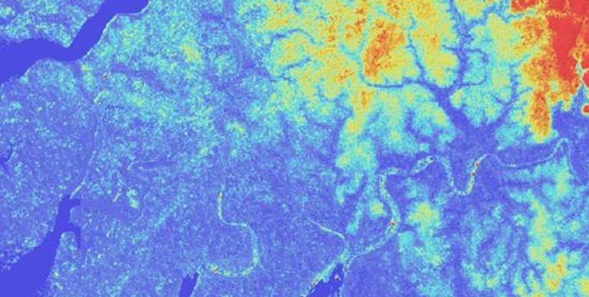
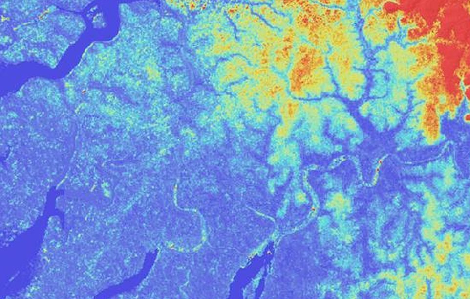
- Acquisition and inspection of SPOT satellite images: It has been possible to use SPOT4 and SPOT5 images acquired over the pivotal year 2010 to create data for the entire Congo basin, an area covering 3.3 million sq.km. A second project to cover the same area began in 2015, this time using SPOT5, 6 and 7 images – around 1.8 million sq.km have been covered so far.
- Publication of images and support: SPOT satellite data on forest coverage and its evolution is made available to the policy-makers and local government entities in each country so that this information can be used to create preservation policies and programmes for the forests of Central Africa. A specific SPOT license was created allowing the recipient counties to distribute the images free of charge to all eligible projects on their request. The process to be followed in order to obtain data is deliberately simple in order to make it accessible to as many entities as possible (with the exception of any use to industrial or commercial ends).
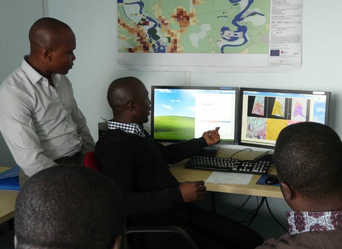
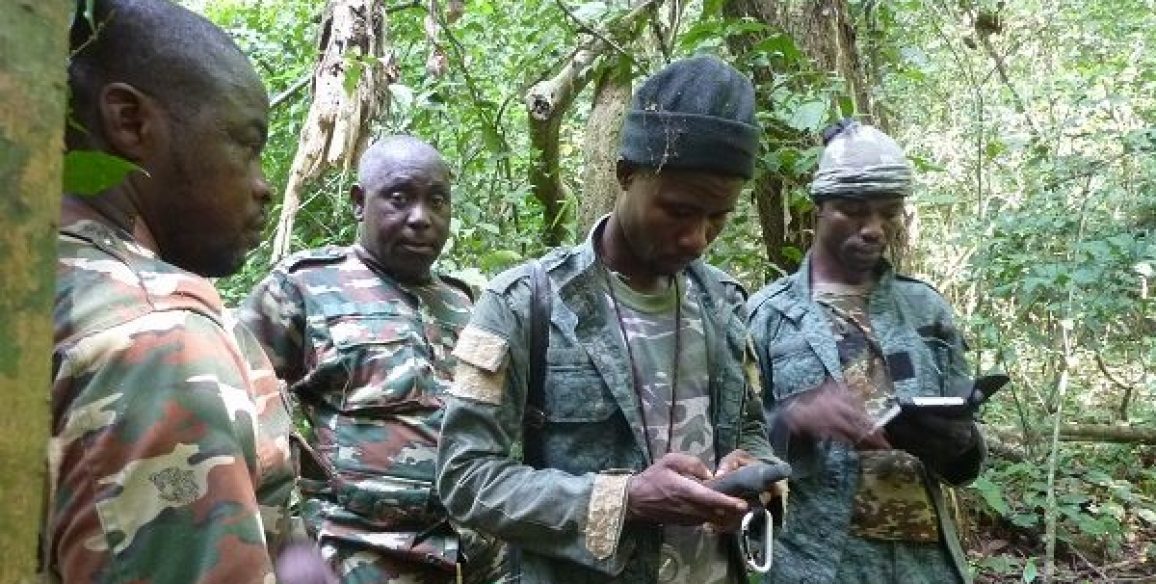
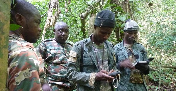
Another important part of the project was a study of local needs, increasing user’s and supporting them in the use of this highly technical data.
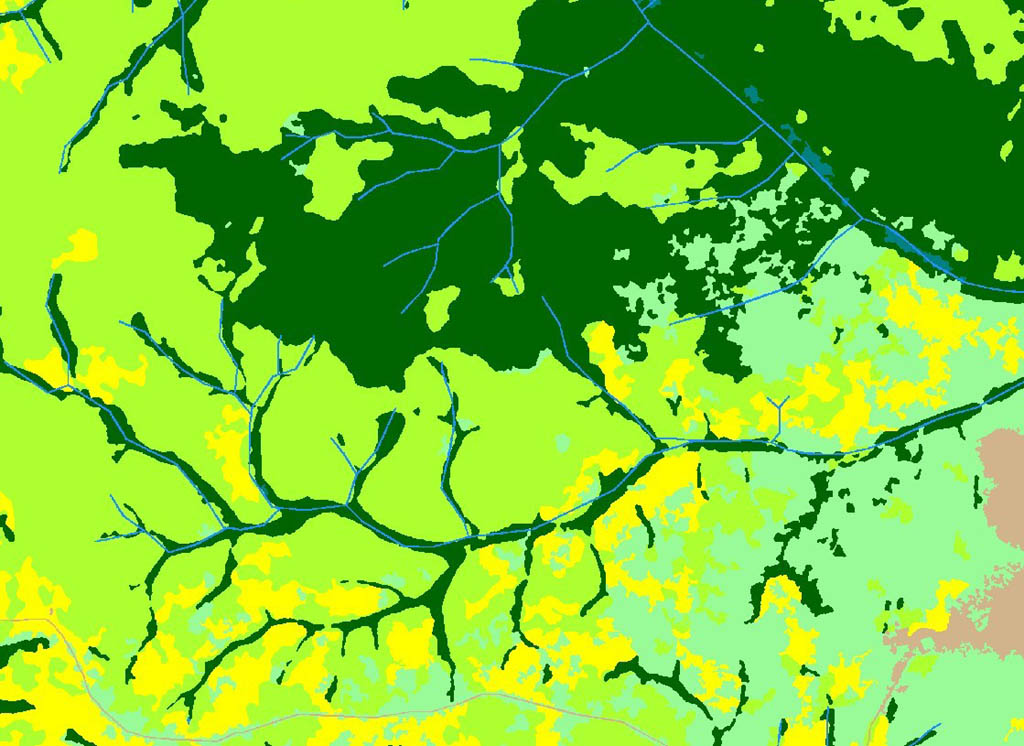
- Production of forest maps : In addition to this, forest maps were created using satellite imagery for an area of more than 600,000 sq.km in Cameroon and the Republic of Central Africa. The products developed were historical forest maps (1990 / 2000 / 2010) and maps showing changes as well as a more detailed map for the year 2010. These maps were checked and validated in line with recommendations from the Intergovernmental Panel on Climate Change (IPCC) in particular. They were made available to both countries in order to help them use the tools to track forest dynamics which have become essential to the preparation phase of the REDD+ mechanism. These maps are freely available.
Key figures
- Orthorectified and validated satellite images for over 3 million sq.km
- 6 countries covered
- Already more than 70 recipient projects using these images
More information (in French)
Revue Impact – Ambassade de France en RDC – Mai 2016
Portail de l’observation des forêts tropicales des forêts du bassin du Congo
Bassin du Congo : les satellites au chevet des forêts – IGN Magazine n°76 – Déc. 2014